Tools for Digitalisation of Agriculture in Ethiopia
Ethiopian ministries and universities require easy access to EO and environmental data to help land restoration projects. During the OEMC project, online maps and tools to monitor vegetation and land productivity will be produced in order to support Ethiopia’s strategic investment framework and natural resource management policy development.
What is the challenge?
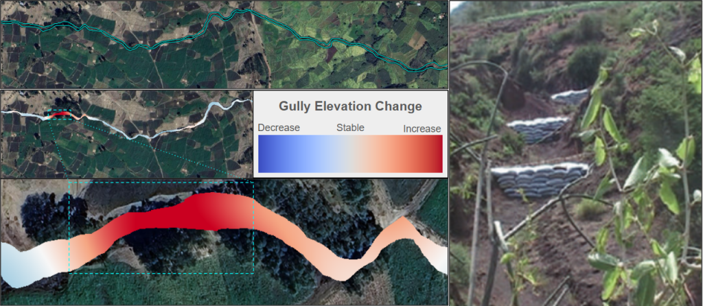
The lack of data collection in Ethiopia thwarts the monitoring of long term changes before and after the sustainable land management implemented by the local community. How much soil is lost in Ethiopia due to gully erosion? How can we find out the impact of disturbance in sustainable land management watersheds under different performance?
Our solution
Long term, time-series data back to 2000 helps monitor the change before and after the intervention around 2010-2015. We use satellite image collection to derive changes and differences to have an objective view.
Time series of elevation measurement show how dams in gullies counter erosion
Who will benefit?
Ministry of Agriculture Ethiopia, Deutsche Gesellschaft für Internationale Zusammenarbeit (GIZ)