Our results for Continental Europe (https://doi.org/10.5281/zenodo.4724549) show that machine learning can be used to remove canopy and buildings, although some post-processing is still needed to create hydrologically correct DTMs. We will next build such a system for the whole world (compare with FABDEM) and then also derive some key terrain variables that can be used for various projects.
What is the challenge?
On the one hand, there is an increasing number of sources of elevation / altitude data while, on the other hand, users typically require only a single functional elevation service, preferably one that most accurately depicts hydrological relationships in a landscape.
Land relief parameterization follows the higher resolution DTM product. Higher resolution data product leads to higher and more intense computation.
Our solution
Machine learning can be used to remove canopy and buildings, although some post-processing is still needed to create hydrologically correct DTMs. We will next build such a system for the whole world (compare with FABDEM) and then also derive some key terrain variables that can be used for various projects.
Integration of WhiteBoxTool developed by a member in ISG, Prof. John Lindsay. Powered by the programme, the efficiency of connecting hydrological and parallelization improves dramatically.
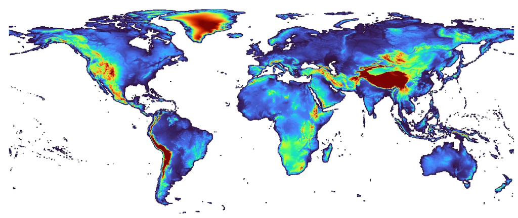
Global 30 meter resolution elevation dataset that was created by combining and improving upon multiple predecessors.
Who will benefit?
Soil scientists, hydrologists, geomorphologists, geologists, as well as the International Society for Geomorphometry will all benefit from this use case.