European forests are facing an upwards trend in disturbance occurrence from (a mix of) natural and anthropogenic sources (Seidl & Senf, 2024). Current remote sensing-based monitoring systems provide yearly updates at 30m resolution using optical data only.
We have developed a 10-m forest disturbance alerting and characterization tool for Europe at 2/3 day revisit rate using radar-based Sentinel-1 data. This data, when combined with optical-based Sentinel-2 data, will allow for the separation between different human and natural forest disturbance types. This will support the EU forest management efforts (e.g. JRC) and climate law efforts (e.g. Green deal, EU Forest Strategy for 2030). Different EU stakeholders will be served incl. country cases.
What is the challenge?
According to recent studies, the forests of Europe are facing an upwards trend in disturbance occurrence from (a mix of) natural and anthropogenic sources (Seidl & Senf, 2024). National efforts to quantify this via traditional methods such as forest inventories are falling short due to their long measurement intervals (5-10 years). Current remote sensing-based monitoring systems can provide yearly updates at 30m resolution based on optical satellite data (Landsat), but the complexity and dynamics of forest disturbances necessitate rapid, intra-yearly disturbance detection capabilities at high spatial detail (< 30m). Optically-based earth observation platforms delivering freely available data such as ESA’s Sentinel-2 provide high spatial detail (10m), but are hindered by frequent cloud coverage in many areas. So far, this has complicated the implementation of optical data for rapid and reliable disturbance monitoring across Europe.
Our solution
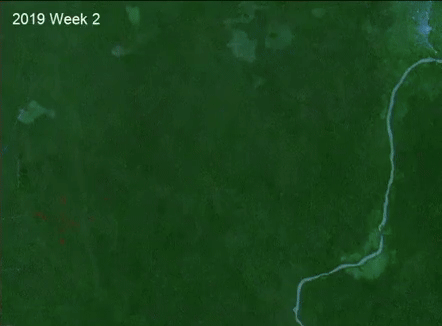
The radar-based Sentinel-1 platform allows for high-resolution (10m pixel spacing) and rapid (3-day revisit intervals) information, unhindered by cloud cover. The RADD (RAdar for Detecting Deforestation) system (Reiche et al. 2021), developed for use in the tropics, has been adapted for European conditions (seasonality, forest types, frozen conditions). A use case in Estonia has been prepared, highlighting the fine spatial and temporal detail of the alerts. Further efforts to combine and supplement optically-based alerts with data obtained from radar-based platforms will greatly improve disturbance monitoring capabilities.
Detected Forest disturbance time series
Who will benefit?
A variety of state actors in the EU such as the Joint Research Center (JRC), European commission, and individual countries, as well as non-state actors such as researchers and private landowners will benefit from increased spatial and temporal detail in the upcoming forest disturbance products. State actors will be able to rapidly identify forest disturbance trends facilitating the development of better policies, and monitor their outcomes more effectively. Non-state actors, such as those in the scientific community will be able to combine this data with other open source datasets to develop a better understanding of the patterns underlying the forest disturbance regimes in Europe.