- These are the two first of a series of hackathons that will be organized by the OEMC project during its development in order to interact with young researchers.
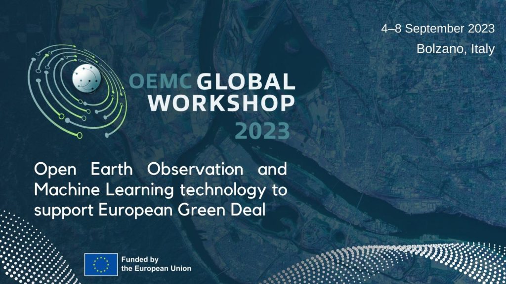
- The winners of each challenge will receive an invitation to present their results at the OEMC Global Workshop in Bolzano, Italy, processing credits in the Open EO platform and, a lifetime subscription to PeerJ Journal.
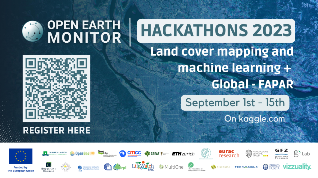
Amsterdam, The Netherlands, June 21, 2023. The Open-Earth-Monitor (OEMC) project launches its first two hackathons and invites young researchers, students and members of the GIS community to explore machine learning solutions for land cover mapping. Similarly, the second hackathon will focus on modeling FAPAR using data-driven approaches. The events will take place online from September 1st to September 15th 2023 and will be hosted by Leandro Parente from OpenGeoHub (OGH) and co-organized by the International Institute for Applied Systems Analysis (IIASA), CREAF, GILAB, the Institute for Geoinformatics of the Münster University (IFGI), Terrasigna and, Eurac Research.
Since a good machine learning challenge needs to be based on a high quality input dataset, the participants of the first hackathon will work with ground-truth data provided by the LUCAS Survey, funded by the European Commission. Using data about land cover, land use, irrigation management and structural elements of European landscapes, the participants will be asked to map these landscapes using satellite images and machine learning models. The participant with the highest accuracy wins the challenge. As of the second hackathon, Global-FAPAR (Fraction of Absorbed Photosynthetic Active Radiation), participants will face a regression problem, i.e. modeling FAPAR at high spatial resolution using data driven approaches and biophysical variables.
You can join us and participate in one of the two challenges by filling out the following registration form. These two hackathons are an opportunity for participants to connect with cutting edge developments and experts in the field of machine learning. It’s also a good chance to improve, share knowledge and build a creditable background within Earth Observation applications.
The winners will be awarded with the chance to assist and present their results at the OEMC Global Workshop taking place in Bolzano, Italy from 4-6 of October. This international event brings together European and global policy-makers, business managers, researchers and civil society to discuss solutions to the greatest challenges in the field of open-source Earth Observation, geospatial applications and state of the art tools to monitor our environment. The winner will also have the opportunity to use the OpenEO Platform, a large-scale cloud platform able to access and analyze billions of satellite images and other Earth Observation data.
The Horizon-Europe project “Open-Earth-Monitor’ aims for accelerating the uptake of key environmental data across borders anchored in FAIR and open data principles. We are convinced that in order to increase usability of OEMC outputs we need to interact with and involve diverse communities. That’s why we strive for including PhD students, young researchers, and members of the GIS community. Moreover, we encourage female researchers to join this challenge, as we believe there is a gap that needs to be filled in by women participating in science.
The Open-Earth-Monitor consortium, formed by 23 international organizations, research institutes and private businesses from Europe and beyond, is also working closely with European Space Agency (ESA), EuroGEO (European members of the Group on Earth Observations) and GEOSecretariat on enabling easier access to environmental information through use cases and workshops.